
 Login
Login
Bull Shoals Lake (West Section), Arkansas/Missouri Waterproof Map (Fishing Hot Spots) – Lake Maps
Store » Lake Maps » Bull Shoals Lake (West Section), Arkansas/Missouri Waterproof Map (Fishing Hot Spots)
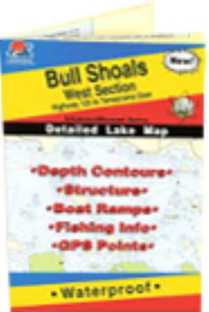 |
Bull Shoals Lake (West Section), Arkansas/Missouri Waterproof Map (Fishing Hot Spots)Hwy 125 to Taneycomo Dam
This superb fishery continues to be one of the famous resources in the nation. Outstanding aesthetics, water clarity and outdoor recreation opportunities account for the popularity. Largemouth & white bass, white & black crappie & cannel cats abound. This detailed map provides depth contours, structure, boat ramps and updated fishing information, with productive spots marked on the map. You'll also find a complete lat/long grid and dozens of GPS waypoints. These four-color maps are as easy-to-use as they are to read! Size - 24 x36
$16.45
Shipping: 0.00
Category: Lake Maps Vendor: Fishing Hot Spots Vendor Item #: L172 Inventory: 2 Dated Added:  |
|
Quick Links Bull Shoals Lake News Bull Shoals Lake Photos Bull Shoals Lake Videos |


